Valle de Tenza, Boyacá -
If I give the following clues about this place, how many of you would be able to find out what this place is?
1. This town used to be an important trade stop between the indigenous people from the Andes and the llanos (Colombian plains) before the colonial period. Trade used to be on emerald and salt.
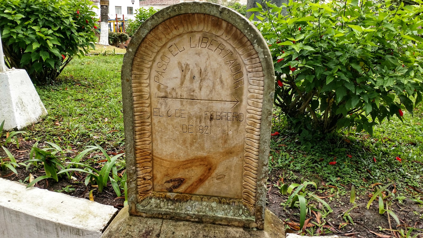
2. The Spanish conquered this region from the cacique of Cora looking for esmerladas (emeralds). The cacique of Cora was a subordinate to the Zaque of Hunza.
That is Tenza for you. Well, Tenza, Boyacá.
How did I find out about Valle de Tenza
The way I got to know about tenza is a bit curious. There are lots of yellow buses from Valle de Tenza that go from Bogotá outward seemingly towards this unknown region. When I got to research about this place, there is not a lot of available information online about this region.
The more I learnt about this place, the more interested I was in visiting this region. To me it appears that this region completely disappeared of the tourist map of Colombia or for that matter from the tourist map of Boyacá
Where is Valle de Tenza
Valle de Tenza or Tenza valley is a region in south eastern Boyacá and north eastern Cundinamarca bordering the Cundiboyacense plateau in the west. This region was an important trade route in pre-colombian history between the High Andes and the Colombian plains of the Orinoco basin. The items of trade were emeralds and salt mined from the region. The communities involved were Muisca from the Andes and the Tengua from the plains.
Tenza valley is formed by rivers such as Somondoco river, Lenguapá river, Tunjita river, Sucio negro river, and Batá river. These rivers eventually form part of the Orinoco river basin. The valley varies in heights from about 2100 meters in the west to just about 400 meters in the east.
The following towns are a part of the Tenza valley region:
- In Boyacá - From the Neira and the eastern provinces
- Neira - Chinavita, Garagoa, Macanal, Pachavita, San Luis de Gaceno and Santa María
I had the opportunity to travel to this wonderful region albeit a short visit to Macheta, Tenza, Guateque and Garagoa.
For the purpose of making it easy to follow I am going to focus on one town as the destination - Tenza, the town that gives the name for the valley.
How to reach Tenza
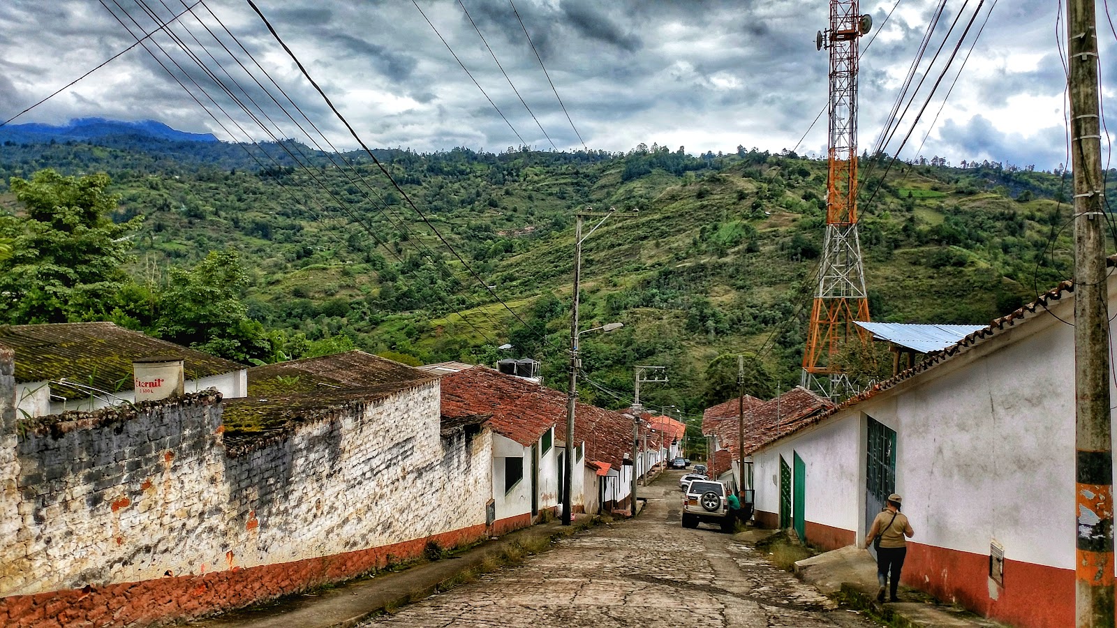
Tenza is situated in the middle of the valley at about a height of 1600 meters above sea level. This makes the climate very pleasant compared to the colder climate of the Cundiboyacense plateau. The change in climate can be felt from the moment you reach Macheta as the road takes you through the slopes of the eastern Andes mountains.
To reach Tenza:
1. Take the Autopista norte towards Tunja. This is called the Autopista Norte or by its official name - The Liberators’ highway - Avenida de los libertadores

2. After crossing el sisga reservoir, take the exit to the right towards Macheta, Cundinamarca. Macheta is about 2100 meters above sea level and the weather changes can be noticed here. The moment of relief that you can go outside without a sweater is pleasing.
Scene towards the mountains in Machetá

3. Continue eastwards towards Guateque, which is the first town in Boyacá on this side. Guateque Is about 1850 meters above sea level.
4. Once in Guateque, take the road to Sutatenza and here the roads are not very good. The road is a dirt road and hence advisable to take it during non rainy season.
Guateque Center

A dirt road towards Tenza
5. From Sutatenza, Tenza is just 40 minutes away on a dirt road. Tenza is just 1600 meters above sea level.
To Stay
There are no hotels in Tenza available on any website. The only available hotel is a convent converted to a hotel and is run by the Alcadia de Tenza (Tenza Municipality's hotel). Call the hotel in advance to book your stay. The hotel was old but well maintained and even has a swimming pool. There are not a lot of restaurants in town, hence be ready for lowering expectations.
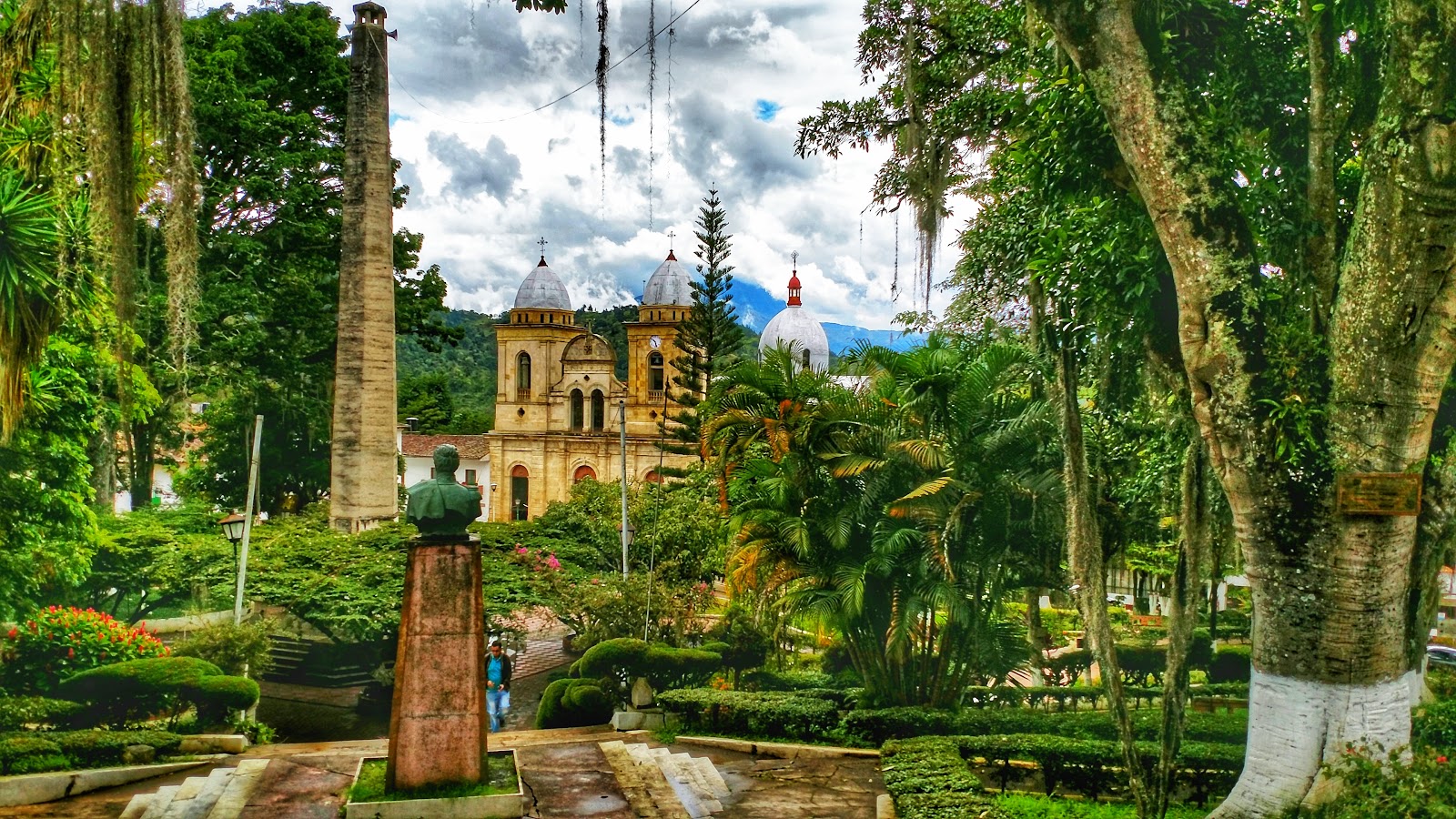


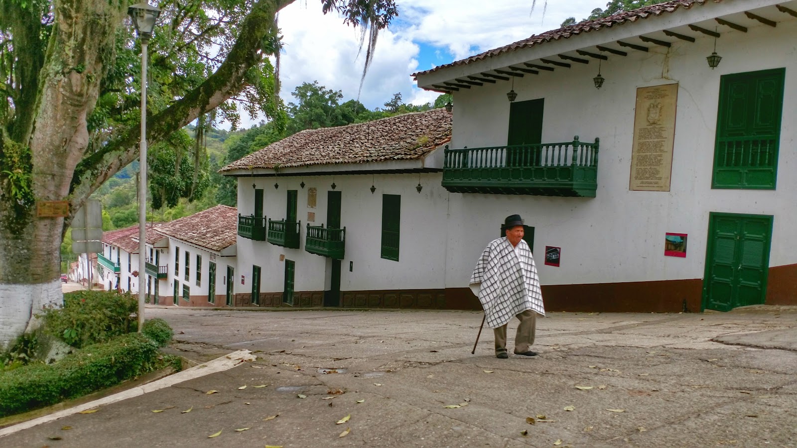

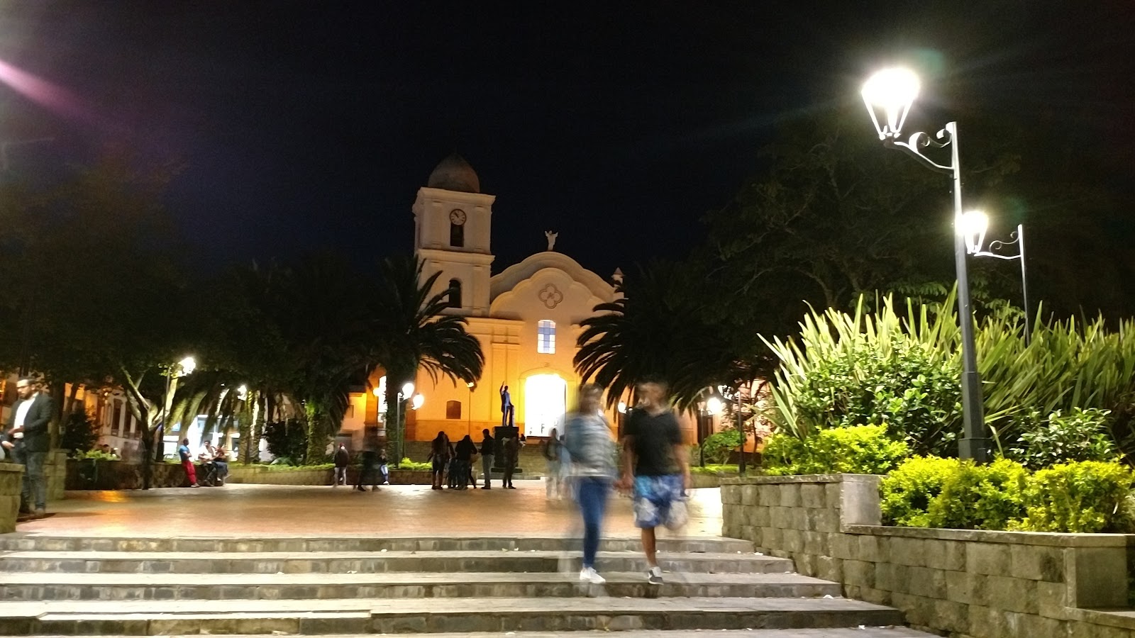
The walk around the center in Tenza is very pretty. The calm of the rural life with friendly people around teaches a lot of things. To slow down and pause once in a while is necessary to keep up with things in life. Take things as they are and enjoy the moment. Tenza in that aspect is like an island in the middle of a beautiful family, though as per maps is just about 3.5 hours away from Bogotá, this is another world altogether. The scenes in the small towns in this region are pretty and the main scenic attraction would be the Chivor reservoir which is just about 45 minutes away from Tenza. This place also has some of the oldest land tunnels of Colombian roads. La central hidroeléctrica de Chivor is a large dam in Santa Maria, Boyacá produces about 8% of all of Colombia's energy.
Buses to Tenza are from Flota Valle de Tenza and can be taken either from the terminal de transporte or the terminal satelite in the north.
Despite the beauty and the climate, Tenza does not feature in touristic maps of Colombia.


Comments
Post a Comment